Hiking Project Logo

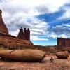
A steep climb up to a hidden valley with towering red cliffs on either side.


Your Rating: Rating Rating Rating Rating Rating      Clear Rating
Your Difficulty:
Your Favorites: Add To-Do · Your List
Zoom in to see details
Map Key

6.4

Miles

10.4

KM

Out and Back

5,264' 1,605 m

High

4,597' 1,401 m

Low

1,107' 337 m

Up

1,106' 337 m

Down

7%

Avg Grade (4°)

44%

Max Grade (24°)

Dogs Leashed

Features Views

Overview

A relatively short Moab classic offering big cliffs and phenomenal views.

Description

The trail starts with a steep climb up to the mouth of the valley. There are numerous large step-ups with loose rocks, sand, and switchbacks making it difficult to hike. After approximately three-quarters of a mile, you reach the top of the climb and enter the valley. The trail from here to the end of the valley is hard-packed dirt with gradual inclines and very few rocks or obstacles, and some short sections of sand.

At 1.6 miles, you reach the top of the valley, and the trail starts to descend toward the Colorado River. The scenery changes from tall red cliffs to rolling, yellow sand dune rock formations. Here the trail is more difficult to follow so keep your eyes out for cairns—small piles of stacked rocks that mark the trail. The trail crosses variable terrain including slickrock, loose rock, and doubletrack roads with small sections of sand. The trail ends where it meets the Moab Rim Trail at mile 3.3. You can retrace your steps to the trailhead or arrange a shuttle and continue down the Moab Rim Trail to Kane Creek Road.

Contacts

Shared By:

Amy White

Trail Ratings

  4.3 from 15 votes

#1345

Overall
  4.3 from 15 votes
5 Star
47%
4 Star
40%
3 Star
13%
2 Star
0%
1 Star
0%
Recommended Route Rankings

#95

in Utah

#1,345

Overall
31 Views Last Month
3,719 Since Nov 3, 2017
Intermediate/Difficult Intermediate/Difficult

0%
0%
36%
36%
27%
0%

Photos

View from the top of the climb
Nov 3, 2017 near Moab, UT
View looking back down the valley, La Sal mountains in the background.
Nov 3, 2017 near Moab, UT
Perfect Day!
Mar 4, 2021 near Moab, UT
View from top of the pass
Nov 3, 2017 near Moab, UT
Hidden Valley. Please use existing trails and avoid creating new tracks by trampling vegetation and fragile biological soil crusts.
Nov 3, 2017 near Moab, UT

0 Comments

Weather


Current Trail Conditions

Unknown
Add Your Check-In

Check-Ins

Jan 29, 2022
Josh M
Mar 4, 2021
John McCool
Perfect day! 3.5mi — 2h 30m
Nov 27, 2020
Lisa Munsch
Thanksgiving 2020 Casey and Maddie
Sep 30, 2020
Morgan L
Jun 8, 2020
Jessica Luty
Nov 3, 2019
Amanda Waltz
Jun 2, 2019
Brandon Snacks
Mar 22, 2019
Atsuko Ohtake
overcast cool day. Hiking with Rocky my daughter's 5 month old tiny puppy.
Welcome

Join the Community

Create your FREE account today!
Already have an account? Login to close this notice.

Get Started