
Land Manager: USFS - Coronado National Forest Office
 Bear Canyon Loop
16.9 mi 27.2 km • 2,465' Up 751.48 m Up • 2,456' Down 748.6 m Down

 Catalin…, AZ
 Babat Duag Out-and-Back
4.6 mi 7.4 km • 1,180' Up 359.74 m Up • 1,180' Down 359.55 m Down
Tanque…, AZ
 Wildhorse to Douglas Springs Loop
3.1 mi 4.9 km • 157' Up 47.95 m Up • 152' Down 46.19 m Down
Bridal Wreath Falls
5.8 mi 9.4 km • 1,066' Up 325 m Up • 1,066' Down 324.96 m Down
Romero Pools
4.9 mi 7.9 km • 1,047' Up 319.2 m Up • 1,046' Down 318.88 m Down
Oro Valley, AZ
 Safford Peak
3.4 mi 5.5 km • 1,490' Up 454.08 m Up • 1,489' Down 453.96 m Down

 Continue with onX Maps
 Continue with Facebook


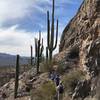
 Particularly Special Place


0 Comments