Hiking Project Logo

A great 13.2 mile trail in the San Gabriel Mountains.


Your Rating: Rating Rating Rating Rating Rating      Clear Rating
Your Difficulty:
Your Favorites: Add To-Do · Your List
Zoom in to see details
Map Key

13.2

Miles

21.3

KM

Point to Point

6,050' 1,844 m

High

3,067' 935 m

Low

1,464' 446 m

Up

4,288' 1,307 m

Down

8%

Avg Grade (5°)

38%

Max Grade (21°)

Dogs Leashed

Description

Starting at Three Points, the Silver Moccasin Trail is a great hike in the Angeles National Forest. The section from Three Points to Christian Camp is relatively flat and an easy. After Christian Camp it begins to descend to Bandito Camp and then to Horse Flats with some climbing in between. After Horse Flats campground, the trail gets a little rougher with lots of chunky rock and water-bars in the descent to Chilao/ 3N14 junction. If you are doing the Mt Hillyer Loop, you'll want to turn right here.

After Chilao, the next section links up to Vetter Mountain. There is one descent that has some loose footing, but be aware that there is also an ascent up a road between the two. This section has seen major impacts from the station fire. Nearly all of the trees are dead, and deadfall is a common problem on trail. Hikers will also see lots of poodle dog bush-stay away from this!

Once you reach the Vetter/Charlton Flats area, the descent to Big Tujunga Creek is a little bit challenging relative to earlier sections of trail. After reaching Big Tujunga Creek, there is a spur trail that goes up to Big Tujunga Canyon road, while the main trail climbs out to the Angeles Crest Highway. After crossing the ACH, the trail descends a shortcut canyon down to West Fork Campground in the canyon north of Mt Wilson.

Contacts

Shared By:

Alex Fore

Trail Ratings

  4.0 from 1 vote

#15017

Overall
  4.0 from 1 vote
5 Star
0%
4 Star
100%
3 Star
0%
2 Star
0%
1 Star
0%
Trail Rankings

#1,552

in California

#15,017

Overall
11 Views Last Month
1,417 Since Aug 10, 2017
Difficult Difficult

0%
0%
0%
0%
100%
0%

Photos

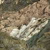
Shady West Fork Trail camp next to river.
Apr 15, 2018 near Sierra…, CA
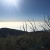
Silver Moccasin Trail
Aug 10, 2017 near Sierra…, CA
loading

Weather


Current Trail Conditions

Unknown
Add Your Check-In

Check-Ins

Aug 26, 2018
Jordan Brown
Chilao Rd (near campground) to Visitor Center, and return 1.2mi — 0h 45m
Sep 21, 2017
Valerie Norton
Chilao to Hillyer: https://valhikes.blogspot.com/2017/09/mount-hillyer.html
Apr 2, 2017
Angeline Villasenor
Welcome

Join the Community

Create your FREE account today!
Already have an account? Login to close this notice.

Get Started