
 Continue with onX Maps
 Continue with Facebook


 Particularly Special Place


 Intermediate
Intermediate
Intermediate
 Intermediate
Land Manager: USFS - Angeles National Forest Office
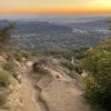
 Mt Lukens Road Saddle Out-and-Back
5.2 mi 8.4 km • 1,182' Up 360.31 m Up • 1,181' Down 359.91 m Down

 La Crescenta: Tee Pee Out and Back
2.9 mi 4.7 km • 1,292' Up 393.75 m Up • 1,292' Down 393.67 m Down
 La Caña…, CA
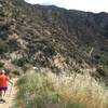
Bear Canyon Trail Camp
La Caña…, CA
Bear Canyon Trail Camp
6.6 mi 10.7 km • 1,246' Up 379.76 m Up • 1,246' Down 379.84 m Down
Cooks Canyon Lookout
1.4 mi 2.3 km • 310' Up 94.6 m Up • 310' Down 94.6 m Down
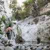
Arroyo Seco
8.3 mi 13.3 km • 541' Up 165.01 m Up • 542' Down 165.17 m Down
La Caña…, CA
 Mt. Lowe from Eaton Saddle
5.6 mi 9.1 km • 1,451' Up 442.3 m Up • 1,451' Down 442.24 m Down


1 Comment