Hiking Project Logo

Hike along this ridge to reach views of the Santa Ynez Valley.


Your Rating: Rating Rating Rating Rating Rating      Clear Rating
Your Difficulty:
Your Favorites: Add To-Do · Your List
Zoom in to see details
Map Key

3.8

Miles

6.2

KM

Point to Point

2,657' 810 m

High

1,041' 317 m

Low

121' 37 m

Up

1,737' 529 m

Down

9%

Avg Grade (5°)

25%

Max Grade (14°)

Dogs Unknown

Features Views

Description

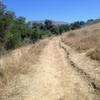
This trail begins off of East Camino Cielo at the parking area and Forest Service gate. Following the Fremont Ridge Trail to the northwest you'll descend steeply for the first 1/4 of a mile before the trail mellows out a bit. You then steadily climb the trail along a low grade until you're 1 mile from the trailhead. At this point the path descends very steeply into the valley and most people stop their hike at this point before returning to the trailhead along the same route they followed up. There are great views of Cachuma Lake and the Los Padres mountains at this turnaround point. If you wish to continue along the trail you can follow it as it winds its way all the way to Paradise Rd., at which point it terminates.

Thanks to John McKinney, The Trailmaster, for sharing this trail description. To learn more about trails in California, check out his guides at The Trailmaster Store.

Contacts

Shared By:

John McKinney

Trail Ratings

  2.5 from 2 votes

#44202

Overall
  2.5 from 2 votes
5 Star
0%
4 Star
0%
3 Star
50%
2 Star
50%
1 Star
0%
Trail Rankings

#4,584

in California

#44,202

Overall
5 Views Last Month
615 Since Jul 20, 2017
Intermediate/Difficult Intermediate/Difficult

0%
0%
50%
50%
0%
0%

0 Comments

Weather


Current Trail Conditions

All Clear 51 days ago
Add Your Check-In

Check-Ins

none

Stewarded By

Welcome

Join the Community

Create your FREE account today!
Already have an account? Login to close this notice.

Get Started