
 Continue with onX Maps
 Continue with Facebook


 Particularly Special Place


 Intermediate
Intermediate
Intermediate
 Intermediate
Land Manager: North Carolina State Parks - Gorges State Park
 High Hampton Inn to Chimney Top Peak
4.3 mi 6.9 km • 1,220' Up 371.81 m Up • 1,220' Down 371.98 m Down
 Cullowhee, NC
 Panthertown Valley Loop
5.5 mi 8.8 km • 822' Up 250.45 m Up • 791' Down 241.13 m Down
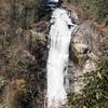
Lower Whitewater Falls Hike
4.3 mi 6.9 km • 843' Up 257.09 m Up • 844' Down 257.11 m Down
 Walhalla, SC
 Bracken Preserve Loop
4.6 mi 7.5 km • 767' Up 233.86 m Up • 766' Down 233.62 m Down
Brevard, NC
John Rock Loop
5.7 mi 9.1 km • 975' Up 297.1 m Up • 970' Down 295.68 m Down
Brevard, NC
Fish Hatchery to Ellicott Rock Loop
16.8 mi 27.1 km • 3,350' Up 1020.98 m Up • 3,332' Down 1015.5 m Down


0 Comments