
 Continue with onX Maps
 Continue with Facebook


 Particularly Special Place


 Difficult
Difficult
Difficult
 Difficult
Land Manager: Virginia State Parks - Shenandoah River State Park
 Signal Knob
10.6 mi 17.1 km • 2,098' Up 639.37 m Up • 2,136' Down 650.93 m Down

 Strasburg, VA
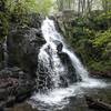
Overall Run Falls
Strasburg, VA
Overall Run Falls
6.3 mi 10.2 km • 1,348' Up 410.97 m Up • 1,348' Down 410.94 m Down
Tuscarora to Toms Brook: Shenandoah and GW
55.8 mi 89.8 km • 10,087' Up 3074.59 m Up • 10,088' Down 3074.67 m Down
 Lands Run Gap to Hickerson Hollow
2.1 mi 3.4 km • 565' Up 172.13 m Up • 566' Down 172.39 m Down
North Marshall
0.6 mi 1.0 km • 152' Up 46.21 m Up • 151' Down 46.08 m Down
 Little Devil Stairs with AT Loop
12.4 mi 19.9 km • 2,420' Up 737.65 m Up • 2,384' Down 726.68 m Down
Washington, VA


0 Comments