Hiking Project Logo

This is an awesome loop hike leading up to Green Peak via Temescal Canyon and the Bienvenida Trail.


Your Rating: Rating Rating Rating Rating Rating      Clear Rating
Your Difficulty:
Your Favorites: Add To-Do · Your List
Zoom in to see details
Map Key

7.7

Miles

12.5

KM

Lollipop

1,907' 581 m

High

289' 88 m

Low

1,649' 503 m

Up

1,649' 503 m

Down

8%

Avg Grade (5°)

32%

Max Grade (18°)

Dogs No Dogs

Features Views

Overview

This route provides a challenging amount of climbing, only leveling out briefly for some great ocean views before climbing again until the summit of Green Peak.

Need to Know

Water is only available in Temescal Canyon.

Description

Start from the trailhead right off of Sunset Blvd which first descends into Sullivan Canyon. There are a few trails that could get you sidetracked, but keep going straight-ish.

You'll cross through the main Temescal Canyon area where the Temescal Ridge Trail extends up to the left, but keep going straight and stay on Temescal Canyon Trail. Trail will trend up until you reach the bridge and 'waterfall' before curving around to the left and continuing to climb.

After 1.5 miles or so you'll pass by a trail climbing up to the left to a lookout and Bienvenida, you'll tag these on the way back. Continue on the main trail and you'll top out on a nice ocean vista. Approximately .5 miles on you'll reach Skull Rock and pass by it on the right. The trail will continue on for another two miles or so, rising and falling on some fun singletrack until you see the final climb up to Green Peak.

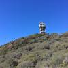
A fence enclosed structure sits at the top and the views of surrounding Santa Monica Mountains are pretty great. Descend all the way back down to the Bienvenida trail that now goes up and over to the right.

Bienvenida will start a nice section of winding singletrack that has a few potential turnoffs. Stay left until the second sign indicating the trail to Sunset, then take a right. Bomb down the Temescal Ridge Trail but watch your step. You'll meet back up with the initial canyon trail to the right and have about .5 mile back to the trailhead.

Shared By:

William Sipes

Trail Ratings

  3.6 from 7 votes

#4648

Overall
  3.6 from 7 votes
5 Star
14%
4 Star
43%
3 Star
29%
2 Star
14%
1 Star
0%
Recommended Route Rankings

#635

in California

#4,648

Overall
13 Views Last Month
3,532 Since Sep 27, 2016
Intermediate Intermediate

0%
10%
90%
0%
0%
0%

Photos

The Temescal Canyon Trail heads through a foliage tunnel.
Mar 17, 2017 near Santa M…, CA
Skull's-eye View - looking through Skull Rock.
Oct 16, 2020 near Topanga, CA
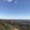
While there's plenty of urban sprawl below, up here, you feel like you're on a different world.
Mar 17, 2017 near Santa M…, CA
Canyon shaded view
Jan 2, 2018 near Santa M…, CA

0 Comments

Weather


Current Trail Conditions

Unknown
Add Your Check-In

Check-Ins

Aug 14, 2021
Carl Hartenstein
7.9mi — 2h 49m
Feb 5, 2021
Vitali K
Jul 30, 2020
Patrick Diaz
7.5mi — 3h 06m
Jan 11, 2020
Anthony Boyer
7.4mi — 4h 37m
May 5, 2019
Taylor H
8mi — 2h 42m
Apr 6, 2019
Lindsey Watson
7.2mi — 3h 12m
Feb 18, 2019
Danijel Mocic
Aug 19, 2018
M Weston
Was on the trail at 7:00 am which was perfect to beat the heat and the crowds. Perfect combination of exposed trail and shade. A semi strenuous hike. 8mi — 2h 45m
Welcome

Join the Community

Create your FREE account today!
Already have an account? Login to close this notice.

Get Started