Hiking Project Logo

A beautiful, short hike to Red Rock Falls along Lewis Creek.


Your Rating: Rating Rating Rating Rating Rating      Clear Rating
Your Difficulty:
Your Favorites: Add To-Do · Your List
Zoom in to see details
Map Key

2.9

Miles

4.6

KM

Point to Point

4,327' 1,319 m

High

3,464' 1,056 m

Low

905' 276 m

Up

118' 36 m

Down

7%

Avg Grade (4°)

23%

Max Grade (13°)

Dogs Leashed

Features Birding · Fall Colors · River/Creek · Spring · Swimming · Waterfall

Family Friendly The entire trail is safe and easy. The only potential tricky part is crossing the creek at the very start.

Description

The trailhead is located at a pullout off of Highway 41 heading north towards Yosemite. It's about 9 miles north of Oakhurst and just past the 4000 feet of elevation sign. The trail has a short downhill to start and crosses Lewis Creek. They took the bridge down recently, but when the creek is low, there are plenty of rocks to use to cross without getting wet.

After this, you cross a couple more bridges over inlets into the creek, but the trail stays on the east side of the creek the rest of the way. You'll hear Red Rock Falls before you can see it, and the trail will come to a fork. If you stay to the right, the trail will lead up to Sugar Pine; to the left leads to the waterfall. It's 1.9 miles to the waterfall so roundtrip is just under 4 miles. This is a great route for kids and dogs.

Mountain bikers do use this trail as well but there are very few blind spots, so they can usually be spotted ahead.

Contacts

Shared By:

Ryan Johnston

Trail Ratings

  4.5 from 17 votes

#406

Overall
  4.5 from 17 votes
5 Star
65%
4 Star
18%
3 Star
18%
2 Star
0%
1 Star
0%
Trail Rankings

#44

in California

#406

Overall
89 Views Last Month
10,927 Since Sep 24, 2016
Intermediate Intermediate

0%
0%
87%
0%
13%
0%

Photos

Microtus montanus
Feb 8, 2022 near Oakhurst, CA
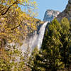
Red Rock Falls
Sep 24, 2016 near Oakhurst, CA
There are several small waterfalls along the hike
Apr 3, 2022 near Oakhurst, CA
Small bridge over a side inlet into Lewis Creek
Sep 24, 2016 near Oakhurst, CA
loading

Weather


Current Trail Conditions

Unknown
Add Your Check-In

Check-Ins

Apr 22, 2021
Alden Eye
Easy hike outside of Yosemite. Red rock falls was neat but there are stunning falls if you make a right turn and follow the river down a bit. 2.9mi — 2h 00m
Jun 8, 2020
Cecilia Espinoza Rodriguez
2.9mi
May 20, 2020
Jason Johnson
Dec 29, 2019
David Haughton
Jul 20, 2019
Jacob White
Jun 30, 2019
Katherine Brisco
Bridge still down to cross creek, but fallen log and rope to right that is safe to cross.
Jun 29, 2019
Walter Ramirez
May 23, 2019
Moussa Jabbour
Welcome

Join the Community

Create your FREE account today!
Already have an account? Login to close this notice.

Get Started