
 Continue with onX Maps
 Continue with Facebook


 Particularly Special Place


 Easy/Intermediate
Easy/Intermediate
Easy/Intermediate
 Easy/Intermediate
Local Club: American River Parkway Foundation
Land Manager: California State Parks - Gold Fields District
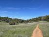
 Cronan Ranch Loop
6.2 mi 10.1 km • 771' Up 234.94 m Up • 760' Down 231.53 m Down

 Pilot Hill, CA
 Auburn Overlook Park Western States-Quarry Trails Loop (20 miles)
21.1 mi 33.9 km • 3,215' Up 980.06 m Up • 3,218' Down 980.86 m Down
Auburn, CA
Marshall Monument Loop
3.5 mi 5.6 km • 600' Up 182.96 m Up • 585' Down 178.21 m Down
Placerv…, CA
Foresthill Divide Loop
11.2 mi 18.0 km • 1,087' Up 331.19 m Up • 1,087' Down 331.23 m Down
Auburn…, CA
 Seasonal Wetland Loop
3.1 mi 5.1 km • 10' Up 3.17 m Up • 12' Down 3.8 m Down
Independence Flat Trail Loop
4.3 mi 6.9 km • 754' Up 229.71 m Up • 753' Down 229.61 m Down
Jackson, CA


 All Clear


0 Comments