
Land Manager: NPS - Valley Forge National Historical Park
 Walnut Hill Commissary & River Trails Loop
6.5 mi 10.5 km • 183' Up 55.65 m Up • 181' Down 55.14 m Down
 Chester…, PA
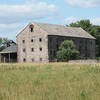
 Valley Creek and Knox Farm
1.0 mi 1.6 km • 67' Up 20.37 m Up • 71' Down 21.77 m Down
 Skippack Creek Full Loop
4.7 mi 7.5 km • 355' Up 108.32 m Up • 357' Down 108.74 m Down
 St Peters Big Run
21.7 mi 34.9 km • 2,169' Up 661.24 m Up • 2,184' Down 665.57 m Down
Wissahickon Valley Park
5.7 mi 9.2 km • 501' Up 152.76 m Up • 500' Down 152.48 m Down
Wyndmoor, PA
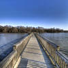
 John Heinz: East Loop
3.7 mi 6.0 km • 60' Up 18.23 m Up • 60' Down 18.21 m Down

 Continue with onX Maps
 Continue with Facebook


 Particularly Special Place


0 Comments