
 Continue with onX Maps
 Continue with Facebook


 Particularly Special Place


 Intermediate/Difficult
Intermediate/Difficult
Intermediate/Difficult
 Intermediate/Difficult
Land Manager: USFS - Gallatin National Forest Office
 Truman Gulch
4.8 mi 7.8 km • 1,281' Up 390.37 m Up • 1,282' Down 390.75 m Down
 Bozeman, MT
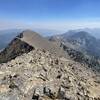
 Sacagawea Peak
4.2 mi 6.8 km • 1,794' Up 546.91 m Up • 1,793' Down 546.43 m Down
 Bozeman, MT
North Cottonwood Loop
Bozeman, MT
North Cottonwood Loop
3.6 mi 5.9 km • 872' Up 265.81 m Up • 871' Down 265.5 m Down
 Drinking Horse Mountain
2.3 mi 3.7 km • 643' Up 196.07 m Up • 643' Down 196.03 m Down
Bozeman, MT
Bridger Ridge Traverse 2.0 (M to Corbly)
25.9 mi 41.6 km • 8,533' Up 2600.99 m Up • 8,128' Down 2477.29 m Down
Bozeman, MT
Baldy Mountain
10.9 mi 17.6 km • 3,837' Up 1169.65 m Up • 3,837' Down 1169.42 m Down


0 Comments