
 Continue with onX Maps
 Continue with Facebook


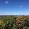
 Particularly Special Place


 Intermediate/Difficult

 Intermediate/Difficult
Local Club: The Trustees of Reservations
 Bear Mountain
5.4 mi 8.7 km • 1,549' Up 472.12 m Up • 1,548' Down 471.96 m Down
 Salisbury, CT
 Brace Mountain Out-and-Back
3.9 mi 6.3 km • 1,445' Up 440.51 m Up • 1,445' Down 440.56 m Down
Sunset Rock
3.8 mi 6.1 km • 1,052' Up 320.51 m Up • 1,051' Down 320.32 m Down
Ledges/Overbrook Loop
2.7 mi 4.3 km • 894' Up 272.42 m Up • 898' Down 273.68 m Down
Macedonia Ridge Trail
6.4 mi 10.3 km • 1,592' Up 485.14 m Up • 1,586' Down 483.51 m Down
Kent, CT
 Sanderson Brook Falls Trail
2.0 mi 3.2 km • 238' Up 72.54 m Up • 239' Down 72.79 m Down


0 Comments