
 Continue with onX Maps
 Continue with Facebook


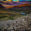
 Particularly Special Place


 Intermediate

 Intermediate
Land Manager: USFS - Dillon Ranger District, White River NF
 Crystal Peak Northeast Ridge
9.5 mi 15.3 km • 3,139' Up 956.89 m Up • 3,136' Down 955.87 m Down

 Mount Democrat
3.8 mi 6.2 km • 2,093' Up 637.91 m Up • 2,092' Down 637.73 m Down
Copper…, CO
 Horseshoe-Hippo-Hay Loop
7.2 mi 11.6 km • 876' Up 267.04 m Up • 872' Down 265.81 m Down
Colorado Trail: Copper Mountain to Camp Hale
18.7 mi 30.1 km • 3,010' Up 917.31 m Up • 3,440' Down 1048.64 m Down
Copper…, CO
Peaks Trail
8.0 mi 12.9 km • 1,213' Up 369.65 m Up • 307' Down 93.49 m Down
Frisco, CO
Back Ranch Loop
7.7 mi 12.4 km • 593' Up 180.6 m Up • 633' Down 193.06 m Down


0 Comments