
 Continue with onX Maps
 Continue with Facebook


 Particularly Special Place


 Intermediate/Difficult
Intermediate/Difficult
Intermediate/Difficult
 Intermediate/Difficult
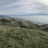
 Monument Peak Summit Out and Back
9.8 mi 15.9 km • 2,491' Up 759.37 m Up • 2,492' Down 759.43 m Down

 Milpitas, CA
 Ohlone Wilderness Trail / Hidden Valley Trail
6.5 mi 10.5 km • 2,083' Up 634.81 m Up • 2,082' Down 634.6 m Down
 South Fork/Tolman Peak Loop
5.2 mi 8.4 km • 884' Up 269.43 m Up • 884' Down 269.31 m Down
Monument Peak Loop via BART
6.5 mi 10.4 km • 1,635' Up 498.49 m Up • 1,656' Down 504.71 m Down
Don Castro - Five Canyon Loop
5.6 mi 9.0 km • 910' Up 277.25 m Up • 910' Down 277.39 m Down
Mt. Diablo Summit Loop - South
16.0 mi 25.8 km • 3,679' Up 1121.47 m Up • 3,678' Down 1121.12 m Down
Diablo, CA


0 Comments