
 Continue with onX Maps
 Continue with Facebook


 Particularly Special Place


 Intermediate
Intermediate
Intermediate
 Intermediate
Land Manager: Southern California Edison - The Big Creek Watershed
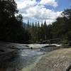
 Rancheria Falls
1.7 mi 2.7 km • 240' Up 73.27 m Up • 241' Down 73.33 m Down

 Auberry, CA
Angel Falls and McLeod Flat from Bass Lake
Auberry, CA
Angel Falls and McLeod Flat from Bass Lake
1.0 mi 1.6 km • 240' Up 73.24 m Up • 240' Down 73.14 m Down
 Pincushion Hill Climb
2.7 mi 4.4 km • 874' Up 266.25 m Up • 872' Down 265.85 m Down
 North Lake to South Lake Loop
55.0 mi 88.5 km • 9,054' Up 2759.53 m Up • 8,482' Down 2585.28 m Down
West Bi…, CA
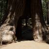
Grand Tour of Sequoias in Mariposa Grove
3.3 mi 5.3 km • 1,092' Up 332.7 m Up • 244' Down 74.42 m Down
Oakhurst, CA
John Muir Trail (JMT)
182.7 mi 294.0 km • 43,234' Up 13177.7 m Up • 32,854' Down 10013.9 m Down
Yosemit…, CA


0 Comments