
 Continue with onX Maps
 Continue with Facebook


 Particularly Special Place


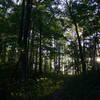
 Intermediate
Intermediate
Intermediate
 Intermediate
 Len Foote Hike Inn Loop
10.1 mi 16.3 km • 1,802' Up 549.37 m Up • 1,812' Down 552.36 m Down

 Boling Creek Park Trails
4.2 mi 6.7 km • 490' Up 149.36 m Up • 489' Down 149.16 m Down

 Pinhoti 3
8.5 mi 13.6 km • 1,361' Up 414.93 m Up • 1,362' Down 415.14 m Down
Chatsworth, GA
Benton MacKaye Trail
287.2 mi 462.3 km • 53,404' Up 16277.4 m Up • 55,479' Down 16910.1 m Down
Dahlonega, GA
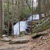
Long Creek Falls
2.0 mi 3.2 km • 264' Up 80.42 m Up • 264' Down 80.39 m Down
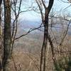
Weaver Creek to Rocky Mountain
6.7 mi 10.8 km • 1,525' Up 464.71 m Up • 1,525' Down 464.68 m Down


0 Comments