
 Continue with onX Maps
 Continue with Facebook


 Particularly Special Place


 Easy/Intermediate
Easy/Intermediate
Easy/Intermediate
 Easy/Intermediate
Land Manager: MA DCR - Middlesex Fells Reservation
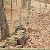
 Skyline Trail
7.5 mi 12.1 km • 846' Up 257.71 m Up • 863' Down 262.89 m Down

 Whipple Hill Loop
2.4 mi 3.8 km • 214' Up 65.25 m Up • 213' Down 65.06 m Down

 Highland Farm Loop
1.4 mi 2.3 km • 39' Up 12 m Up • 39' Down 12.01 m Down
 Beaver Brook Loop
2.6 mi 4.2 km • 256' Up 78.08 m Up • 260' Down 79.11 m Down
Belmont, MA
Mt. Misery Loop
1.9 mi 3.1 km • 200' Up 60.89 m Up • 197' Down 59.92 m Down
 Blue Hills Loop
4.1 mi 6.5 km • 1,171' Up 356.87 m Up • 1,165' Down 355.22 m Down
Dedham, MA


0 Comments