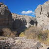
Land Manager: NPS - Big Bend National Park
 Tuff Canyon Trail
0.6 mi 0.9 km • 64' Up 19.55 m Up • 64' Down 19.54 m Down


 Big Ben…, TX
 Oak Springs Trail and The Window
7.8 mi 12.5 km • 1,422' Up 433.52 m Up • 1,422' Down 433.45 m Down


 Big Ben…, TX
 Window Trail
5.6 mi 9.1 km • 914' Up 278.58 m Up • 914' Down 278.67 m Down


 Big Ben…, TX
 Chisos Mountain Loop
16.8 mi 27.1 km • 3,260' Up 993.61 m Up • 3,260' Down 993.67 m Down


 Big Ben…, TX
 South Rim Trail
11.6 mi 18.6 km • 1,984' Up 604.63 m Up • 1,984' Down 604.65 m Down


 Big Ben…, TX
 Lost Mine Trail
4.6 mi 7.4 km • 1,057' Up 322.3 m Up • 1,057' Down 322.18 m Down


 Big Ben…, TX


0 Comments