
 Continue with onX Maps
 Continue with Facebook


 Particularly Special Place


 Intermediate/Difficult
Intermediate/Difficult
Intermediate/Difficult
 Intermediate/Difficult
Land Manager: USFS - Santa Fe National Forest Office
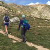
 Nambe Lake Out and Back
6.1 mi 9.8 km • 1,716' Up 522.95 m Up • 1,715' Down 522.79 m Down

 Santa Fe, NM
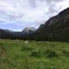
Santa Fe Peaks Tour
Santa Fe, NM
Santa Fe Peaks Tour
23.6 mi 37.9 km • 5,920' Up 1804.34 m Up • 5,805' Down 1769.25 m Down
Santa Fe, NM
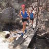
 Chamisa Trail Loop via Saddleback and Windsor
9.9 mi 16.0 km • 1,908' Up 581.68 m Up • 1,897' Down 578.25 m Down
Santa Fe, NM
 West Fork Rio Santa Barbara
20.4 mi 32.9 km • 3,183' Up 970.23 m Up • 3,183' Down 970.1 m Down
Picacho Peak from Cerro Gordo TH
3.4 mi 5.5 km • 1,144' Up 348.71 m Up • 1,143' Down 348.43 m Down
Santa Fe, NM
Soda Springs Loop
9.9 mi 16.0 km • 1,343' Up 409.37 m Up • 1,348' Down 410.77 m Down


1 Comment