
 Continue with onX Maps
 Continue with Facebook


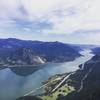
 Particularly Special Place


 Intermediate
Intermediate
Intermediate
 Intermediate
Land Manager: Oregon State Parks
 Indian Point Loop
7.8 mi 12.6 km • 2,898' Up 883.39 m Up • 2,897' Down 883.11 m Down
 Cascade…, OR
 Dry Creek Falls
4.4 mi 7.1 km • 734' Up 223.66 m Up • 734' Down 223.58 m Down
 Panther Creek Falls Trail #137
0.6 mi 1.0 km • 87' Up 26.41 m Up • 86' Down 26.32 m Down
 Carson, WA
Upper McCord Creek Falls
Carson, WA
Upper McCord Creek Falls
1.8 mi 2.9 km • 412' Up 125.63 m Up • 412' Down 125.52 m Down
Cascade…, OR
Three Corner Rock via PCT
4.0 mi 6.4 km • 1,144' Up 348.54 m Up • 1,143' Down 348.42 m Down
 PCT: Lolo Pass to Ramona Falls Trail
15.6 mi 25.0 km • 3,170' Up 966.2 m Up • 3,169' Down 966.05 m Down
Governm…, OR


0 Comments