
 Continue with onX Maps
 Continue with Facebook


 Particularly Special Place


 Difficult
Difficult
Difficult
 Difficult
Local Club: Adams Sno-Drifters
 Bellows Pipe to Mt Greylock Summit
5.8 mi 9.4 km • 2,231' Up 679.9 m Up • 2,231' Down 679.86 m Down

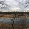
 Mohawk Trail Loop
5.1 mi 8.2 km • 1,133' Up 345.45 m Up • 1,119' Down 341.09 m Down
Charlemont, MA
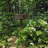
Ledges/Overbrook Loop
2.7 mi 4.3 km • 894' Up 272.42 m Up • 898' Down 273.68 m Down
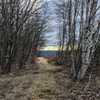
 Leyden Blueberry Fields
7.5 mi 12.1 km • 1,167' Up 355.66 m Up • 1,188' Down 362.11 m Down
Bernard…, MA
Sanderson Brook Falls Trail
2.0 mi 3.2 km • 238' Up 72.54 m Up • 239' Down 72.79 m Down
 Arcadia Walking Loop (No Running Allowed)
0.8 mi 1.4 km • 25' Up 7.7 m Up • 25' Down 7.63 m Down


0 Comments