Dogs Leashed

Features
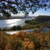
Birding · Fall Colors

Part of this trail goes through private property; respect landowners, and stay on the trail.
Description
From the trailhead at the junction of Wildernest and Vineyard roads, the trail heads north with a sign that says "Archery Range."
The trail is smooth, joyful singletrack, but a little brushy. After about 0.1 mile there is a junction with the
Boom Trail heading to the left (northwest) underneath the power lines; to stay on the Wilderness Trail, just keep climbing. After about a half a mile, the junction with
Hell's Hole invites users to the left; turn right to stay on the Wilderness Trail.
The trail continues up and down heading east, up and down several short, steep climbs. A "hikers only" cutoff can slightly shorten the route, but they end up in the same place.
Continue bearing left—avoid the
Boom Trail, unless you want a much longer outing—and eventually the trail will wind up on the north end of the Horse Campground. You can take Vineyard Road back to the trailhead for an easier finish or come back the way you came.
Contacts
Shared By:
Kenny Slocum

 Continue with onX Maps
 Continue with Facebook


 Particularly Special Place


 Difficult


0 Comments