Dogs Leashed

Features
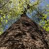
Commonly Backpacked · Fall Colors · River/Creek

Check for bear season dates.
Need to Know
The trailheads were not marked. If I ever needed a map, it was here. Consider taking a map or using the
Hiking Project mobile app to help with navigation.
Description
Note: My description is from the trailhead on Indian Boundary Road. Most trail descriptions start at the wilderness boundary, ignoring 0.5 miles of trail.
From the small parking spot, follow an old bridle path for a half mile until it reaches the wilderness boundary and follows the old road along Citico Creek.
At 0.8 miles, you reach the remnants of an old logging camp. North Fork Citico Creek #98 veers to the left and is marked with a post but no sign. At 1.2 miles you'll find on the opposite bank, Ike Camp Branch, marking the beginning of Brush Mountain Trail #97. There is no sign here, nor post, the only marking of the trailhead being a pink ribbon tied in the lower branches of a tree and a matching ribbon in the lower branches of a tree across the stream.
Around two miles, the trail appears to dead end into a deep crossing, directly across from what appears to be an overgrown trail, possibly an old segment of the South Fork Trail. Turn to the right and up the hillside to continue.
At nearly 2.5, you'll have to ford the stream, shortly before seeing the lone signless post that marks
Grassy Branch Trail #91.
Around mile three, the trail turns to the left and begins a steep incline up to the knob and the railroad grade found there. Along this grade the trail alternates between wide rail bed and narrow ridge side foot path. This section is littered with steel cable, remnants of a logging past.
This section also highlights some of the work done this past summer rehabilitating this trail. Evidence of eroded ridge side trail cleaned with pick and shovel, trimmed rhododendron branches laying about, and nearly impassable groves of briar cut and tamed, for now.
Flora & Fauna
Bear, boar, and raccoons.
Contacts
Shared By:
Shaun Blom

 Continue with onX Maps
 Continue with Facebook


 Particularly Special Place


 Difficult

 4.7 (3)


1 Comment