
 Continue with onX Maps
 Continue with Facebook


 Particularly Special Place


 Intermediate/Difficult
Intermediate/Difficult
Intermediate/Difficult
 Intermediate/Difficult
Land Manager: Lakes Region Conservation Trust
 Welch-Dickey Mountain Loop
4.2 mi 6.8 km • 1,709' Up 520.84 m Up • 1,709' Down 520.85 m Down

 Thornton, NH
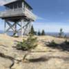
 Mt. Belknap via East Gilford Trail (Yellow)
4.3 mi 6.9 km • 1,285' Up 391.57 m Up • 1,285' Down 391.57 m Down
Gilford, NH
Mount Osceola Out and Back
5.9 mi 9.4 km • 1,952' Up 595.09 m Up • 1,952' Down 595.07 m Down
Mount Major Loop
4.0 mi 6.4 km • 1,163' Up 354.4 m Up • 1,160' Down 353.52 m Down
Wolfeboro, NH
 Copple Crown
5.1 mi 8.2 km • 1,014' Up 309.03 m Up • 1,014' Down 308.99 m Down
Mount Kearsarge North Trail
5.8 mi 9.4 km • 2,485' Up 757.4 m Up • 2,487' Down 758.04 m Down
North C…, NH


0 Comments