
 Continue with onX Maps
 Continue with Facebook


 Particularly Special Place


 Intermediate
Intermediate
Intermediate
 Intermediate
Land Manager: Utah Valley University & Sorensen Family
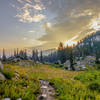
 American Fork Twin Peaks from Silver Lake Flat
12.2 mi 19.7 km • 4,063' Up 1238.4 m Up • 4,065' Down 1239.08 m Down
 Alta, UT
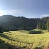
 Alta-Brighton Loop
8.6 mi 13.8 km • 2,297' Up 700.24 m Up • 2,319' Down 706.93 m Down
 Alta, UT
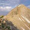
Pfeifferhorn
Alta, UT
Pfeifferhorn
9.6 mi 15.5 km • 3,596' Up 1095.95 m Up • 3,595' Down 1095.87 m Down
Alta, UT
 Stewart Cascades Trail #056
3.6 mi 5.9 km • 680' Up 207.3 m Up • 680' Down 207.27 m Down
Cedar H…, UT
Donut Falls Trail
1.5 mi 2.4 km • 417' Up 127.15 m Up • 416' Down 126.94 m Down
Cottonw…, UT
Deso-Crest-Dog Loop
12.9 mi 20.8 km • 2,770' Up 844.37 m Up • 2,769' Down 843.89 m Down
Alta, UT


0 Comments