
 Continue with onX Maps
 Continue with Facebook


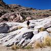
 Particularly Special Place


 Easy
Easy

 Easy
Easy
Land Manager: Maricopa County Parks
 North Top Summit
0.8 mi 1.4 km • 525' Up 160.05 m Up • 0' Down 0 m Down
 Tom's Thumb from Gateway
12.6 mi 20.2 km • 2,591' Up 789.85 m Up • 2,588' Down 788.82 m Down
Camelback Mountain via Cholla Trail
3.2 mi 5.2 km • 1,193' Up 363.49 m Up • 1,190' Down 362.66 m Down
 Paradis…, AZ
 Mesquite Trail Loop
3.8 mi 6.2 km • 182' Up 55.37 m Up • 182' Down 55.59 m Down
Mesquite Canyon/Ford Canyon Trail Loop Clockwise
11.3 mi 18.2 km • 1,789' Up 545.38 m Up • 1,788' Down 545 m Down
Mesquite Canyon Loop
8.7 mi 13.9 km • 1,543' Up 470.39 m Up • 1,542' Down 469.99 m Down
Citrus…, AZ


0 Comments