
 Continue with onX Maps
 Continue with Facebook


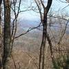
 Particularly Special Place


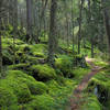
 Intermediate

 Intermediate
 Big Frog/Chestnut Mountain 50K
30.6 mi 49.2 km • 4,566' Up 1391.86 m Up • 4,620' Down 1408.23 m Down
Ducktown, TN
 Pinhoti Run (Bear Creek, Pinhoti, Mountaintown Creek)
13.9 mi 22.4 km • 2,286' Up 696.73 m Up • 2,285' Down 696.62 m Down
Cherry Log, GA
Weaver Creek to Rocky Mountain
6.7 mi 10.8 km • 1,525' Up 464.71 m Up • 1,525' Down 464.68 m Down
 Emery Creek Falls
5.9 mi 9.5 km • 690' Up 210.17 m Up • 689' Down 209.99 m Down
Chatsworth, GA
Slickrock and Citico Wilderness Loop
24.6 mi 39.6 km • 5,503' Up 1677.21 m Up • 5,500' Down 1676.49 m Down
Benton MacKaye Trail
287.2 mi 462.3 km • 53,404' Up 16277.4 m Up • 55,479' Down 16910.1 m Down
Dahlonega, GA


1 Comment