
 Continue with onX Maps
 Continue with Facebook


 Particularly Special Place


 Difficult

 Difficult
Land Manager: BLM Colorado - Colorado River Valley Field Office
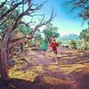
 Red Hill Loop
6.2 mi 10.0 km • 1,139' Up 347.11 m Up • 1,137' Down 346.49 m Down
 Carbondale, CO
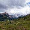
 Capitol Lake, Avalanche Creek, Hell's Roaring Pass Loop
24.6 mi 39.6 km • 6,491' Up 1978.41 m Up • 6,420' Down 1956.74 m Down
Snowmass - Willow Lake Loop
22.3 mi 35.9 km • 5,436' Up 1657.01 m Up • 5,456' Down 1662.91 m Down
Snowmas…, CO
 Grizzly to No Name (Jess Weaver) Loop
11.5 mi 18.5 km • 2,823' Up 860.47 m Up • 2,813' Down 857.46 m Down
 Margy's Hut to Lenado Trailhead
5.8 mi 9.3 km • 25' Up 7.72 m Up • 2,588' Down 788.7 m Down
Aspen, CO
Mount Bellview Out-and-Back
4.8 mi 7.7 km • 1,635' Up 498.46 m Up • 1,635' Down 498.23 m Down
Crested…, CO


0 Comments