
 Continue with onX Maps
 Continue with Facebook


 Particularly Special Place


 Intermediate/Difficult
Intermediate/Difficult
Intermediate/Difficult
 Intermediate/Difficult
Land Manager: USFS - George Washington & Jefferson National Forests
 Blue Suck Falls Loop
8.8 mi 14.1 km • 1,899' Up 578.79 m Up • 1,899' Down 578.79 m Down
 Beards Mountain Loop
6.1 mi 9.8 km • 1,267' Up 386.28 m Up • 1,274' Down 388.44 m Down
 Jump Rock Loop
8.4 mi 13.5 km • 2,282' Up 695.63 m Up • 2,280' Down 695 m Down
 Fenwick Mines Recreation Area
2.1 mi 3.4 km • 161' Up 49.04 m Up • 161' Down 49.14 m Down
New Castle, VA
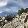
Devils Marbleyard Out and Back
2.8 mi 4.5 km • 778' Up 237.17 m Up • 778' Down 237.09 m Down
 Glasgow, VA
Punchbowl Mountain to James River
Glasgow, VA
Punchbowl Mountain to James River
10.9 mi 17.5 km • 1,814' Up 552.83 m Up • 3,318' Down 1011.25 m Down


 All Clear


0 Comments