
 Continue with onX Maps
 Continue with Facebook


 Particularly Special Place


 Intermediate

 Intermediate
Land Manager: USFS - Pisgah National Forest, Pisgah Ranger District
 Carmen AT Loop
17.0 mi 27.3 km • 3,579' Up 1090.98 m Up • 3,540' Down 1079.07 m Down
 Marshall, NC
 Mt. Sterling Loop (Big Creek / Baxter Creek)
17.7 mi 28.6 km • 4,234' Up 1290.45 m Up • 4,233' Down 1290.07 m Down
Cove Creek, NC
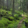
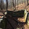
 Rattlesnake Lodge Loop
4.0 mi 6.5 km • 847' Up 258.17 m Up • 847' Down 258.18 m Down
Hemphill Bald Loop
13.8 mi 22.2 km • 2,780' Up 847.26 m Up • 2,787' Down 849.4 m Down
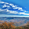
Mount Mitchell Challenge
38.9 mi 62.7 km • 5,089' Up 1550.98 m Up • 5,118' Down 1559.93 m Down
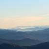
Smokies Challenge Adventure Run (SCAR)
73.1 mi 117.6 km • 14,944' Up 4555.02 m Up • 14,672' Down 4472.16 m Down
Robbins…, NC


0 Comments