
 Continue with onX Maps
 Continue with Facebook


 Particularly Special Place


 Intermediate
Intermediate
Intermediate
 Intermediate
Land Manager: BLM Colorado - Uncompahgre Field Office
 North Vista Trail
6.7 mi 10.8 km • 1,169' Up 356.18 m Up • 1,169' Down 356.24 m Down

 Olathe, CO
 Long Draw (Gulch)
1.8 mi 2.9 km • 1,422' Up 433.33 m Up • 1,422' Down 433.34 m Down
Montrose, CO
Rimrock to Uplands Loop
2.2 mi 3.5 km • 404' Up 123.12 m Up • 406' Down 123.82 m Down
Lion Gulch Trail Out and Back
6.6 mi 10.7 km • 1,671' Up 509.27 m Up • 1,670' Down 509.09 m Down
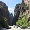
 Avalanche Creek Trail
21.3 mi 34.4 km • 3,834' Up 1168.72 m Up • 3,834' Down 1168.75 m Down
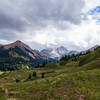
Capitol Lake, Avalanche Creek, Hell's Roaring Pass Loop
24.6 mi 39.6 km • 6,491' Up 1978.41 m Up • 6,420' Down 1956.74 m Down


0 Comments