
 Continue with onX Maps
 Continue with Facebook


 Particularly Special Place


 Easy
Easy

 Easy
Easy
 TOR330_2022_VAR_OYACE
213.9 mi 344.2 km • 78,549' Up 23941.8 m Up • 78,525' Down 23934.3 m Down
Martign…, CH
 Montagne de la Cote
7.1 mi 11.4 km • 3,951' Up 1204.26 m Up • 3,951' Down 1204.18 m Down
 Les Hou…, FR
Hornlihutte
Les Hou…, FR
Hornlihutte
5.0 mi 8.1 km • 2,245' Up 684.39 m Up • 2,245' Down 684.3 m Down
Zermatt, CH
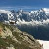
 Index Chairlift to Lac Blanc to Flégère Gondola
6.3 mi 10.2 km • 1,202' Up 366.45 m Up • 2,907' Down 886.09 m Down
Vallorcine to Chalet Col du Balme Hut Loop
4.0 mi 6.5 km • 1,250' Up 381.15 m Up • 1,233' Down 375.8 m Down
Zermatt - Trift - Zmutt Village Loop
13.7 mi 22.1 km • 4,666' Up 1422.07 m Up • 4,663' Down 1421.13 m Down
Zermatt, CH


0 Comments