
 Continue with onX Maps
 Continue with Facebook


 Particularly Special Place


 Easy
Easy
Easy
Easy
 Easy
Easy
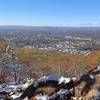
 Heublein Tower from Reservoir 6
6.6 mi 10.6 km • 717' Up 218.54 m Up • 717' Down 218.64 m Down

 Shenipsit Trail
52.2 mi 84.0 km • 5,302' Up 1616.15 m Up • 5,210' Down 1587.93 m Down
 Goat Peak Out-and-Back
0.9 mi 1.5 km • 277' Up 84.39 m Up • 277' Down 84.49 m Down
Eastham…, MA
Will Warren's Den and Lookout
2.5 mi 4.1 km • 421' Up 128.35 m Up • 422' Down 128.65 m Down
 Ragged Mountain Blue and Red Blazed Loop
5.8 mi 9.4 km • 860' Up 262.17 m Up • 857' Down 261.32 m Down
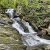
Sanderson Brook Falls Trail
2.0 mi 3.2 km • 238' Up 72.54 m Up • 239' Down 72.79 m Down


0 Comments