
 Continue with onX Maps
 Continue with Facebook


 Particularly Special Place


 Intermediate/Difficult
Intermediate/Difficult
Intermediate/Difficult
 Intermediate/Difficult
Land Manager: USFS - Coronado National Forest Office
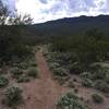
 Seven Falls Out and Back
5.3 mi 8.6 km • 604' Up 184.18 m Up • 604' Down 184.13 m Down

 Catalin…, AZ
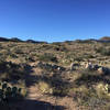
 Sabino Phoneline Sampler
4.0 mi 6.5 km • 538' Up 163.91 m Up • 531' Down 161.99 m Down
Catalin…, AZ
 Wildhorse to Douglas Springs Loop
3.1 mi 4.9 km • 157' Up 47.95 m Up • 152' Down 46.19 m Down
Bridal Wreath Falls Loop
7.3 mi 11.8 km • 1,155' Up 351.95 m Up • 1,154' Down 351.64 m Down
Honeybee Canyon Loop
22.3 mi 35.9 km • 964' Up 293.83 m Up • 964' Down 293.83 m Down
Catalina, AZ
Wasson Peak Circle Route
8.4 mi 13.5 km • 1,905' Up 580.66 m Up • 1,912' Down 582.77 m Down
Tucson…, AZ


 All Clear


0 Comments