
 Continue with onX Maps
 Continue with Facebook


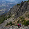
 Particularly Special Place


 Difficult
Difficult
Difficult
 Difficult
Local Club: Washington Trails Association (WTA)
Apr 18, 2024: New trail unveiled in Sammamish, connects city center to trails
Apr 18, 2024: Hiker Headlines: Highway 20 opening, free days, meteor shower, tick season
Apr 18, 2024: Volunteer and Training Coordinator
Land Manager: USFS - Mt. Baker-Snoqualmie National Forest Office
 Mailbox Peak Trail
9.7 mi 15.5 km • 3,848' Up 1173.02 m Up • 3,848' Down 1172.73 m Down

 Riverbend, WA
 Rattlesnake Ledge
4.3 mi 6.9 km • 1,111' Up 338.7 m Up • 1,110' Down 338.42 m Down
Riverbend, WA
 Mt. Si
6.6 mi 10.7 km • 3,281' Up 1000.02 m Up • 3,282' Down 1000.36 m Down
Tanner, WA
Spectacle Lake
19.5 mi 31.3 km • 2,603' Up 793.54 m Up • 2,604' Down 793.57 m Down
Skykomish, WA
Thorp Mountain via Knox Creek
4.3 mi 6.9 km • 2,034' Up 619.98 m Up • 2,034' Down 619.9 m Down
Poo Poo Point via East Sunset Way Trailhead
7.7 mi 12.4 km • 2,110' Up 643.16 m Up • 2,109' Down 642.96 m Down
")


0 Comments