
 Continue with onX Maps
 Continue with Facebook


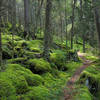
 Particularly Special Place


 Intermediate
Intermediate
Intermediate
 Intermediate
Land Manager: USFS - Pisgah National Forest, Pisgah Ranger District
 Tricorner Knob Loop via Appalachian Trail
34.7 mi 55.8 km • 7,017' Up 2138.89 m Up • 7,017' Down 2138.83 m Down

 Cove Creek, NC
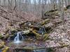
Rough Creek Goodness
Cove Creek, NC
Rough Creek Goodness
7.0 mi 11.3 km • 1,343' Up 409.25 m Up • 1,341' Down 408.61 m Down
Hemphill Bald Loop
13.8 mi 22.2 km • 2,780' Up 847.26 m Up • 2,787' Down 849.4 m Down
 Full CM Gamelands Loop
12.2 mi 19.6 km • 3,002' Up 915.06 m Up • 2,998' Down 913.91 m Down
 Richmond Hill Park Trails
4.1 mi 6.6 km • 412' Up 125.6 m Up • 420' Down 127.95 m Down
 Carmen AT Loop
17.0 mi 27.3 km • 3,579' Up 1090.98 m Up • 3,540' Down 1079.07 m Down
Marshall, NC


0 Comments