
 Continue with onX Maps
 Continue with Facebook


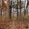
 Particularly Special Place


 Easy
Easy
Easy
Easy
 Easy
Easy
Land Manager: St Louis County, MO - Parks and Recreation
 Western Pool Loop
6.5 mi 10.5 km • 52' Up 15.85 m Up • 52' Down 15.84 m Down
 Lakeside Park
4.5 mi 7.3 km • 17' Up 5.12 m Up • 17' Down 5.27 m Down
Rabbit Run Park Loop
0.9 mi 1.5 km • 60' Up 18.38 m Up • 62' Down 18.77 m Down

 Lewis Trail
7.7 mi 12.5 km • 751' Up 229.04 m Up • 784' Down 239.1 m Down
Weldon…, MO
Dames Park Figure 8
1.2 mi 1.9 km • 29' Up 8.89 m Up • 29' Down 8.72 m Down
 Young Conservation Area
6.5 mi 10.5 km • 585' Up 178.3 m Up • 591' Down 180.11 m Down
Byrnes…, MO


0 Comments