
 Continue with onX Maps
 Continue with Facebook


 Particularly Special Place


 Intermediate/Difficult
Intermediate/Difficult
Intermediate/Difficult
 Intermediate/Difficult
Local Club: The Shenandoah National Park Trust
Aug 9, 2023: Into the Wild: Improving Access to the Outdoors
Jul 31, 2023: The Intern POV: Time & a Place at the Table
Jul 5, 2023: The Intern POV: A Fish out of Water
Land Manager: NPS - Shenandoah National Park
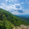
 Mary's Rock Out-and-Back
3.8 mi 6.0 km • 1,105' Up 336.88 m Up • 1,106' Down 337.08 m Down

 Luray, VA
 Little Devil Stairs with AT Loop
12.4 mi 19.9 km • 2,420' Up 737.65 m Up • 2,384' Down 726.68 m Down
Washington, VA
Little Devil Stairs Loop
5.5 mi 8.9 km • 1,453' Up 442.8 m Up • 1,429' Down 435.54 m Down
Washington, VA
 Neighbor Mountain - Jeremys Run Loop
14.0 mi 22.5 km • 2,503' Up 762.95 m Up • 2,509' Down 764.82 m Down
Overall Run Falls
6.3 mi 10.2 km • 1,348' Up 410.97 m Up • 1,348' Down 410.94 m Down
AT/Passamaquoddy/Furnace Springs Loop
2.8 mi 4.5 km • 591' Up 180.22 m Up • 605' Down 184.28 m Down


0 Comments