
 Continue with onX Maps
 Continue with Facebook


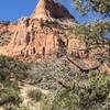
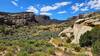
 Particularly Special Place


 Difficult

 Difficult
Land Manager: BLM Colorado - Grand Junction Field Office
 Jouflas Loop
7.8 mi 12.6 km • 644' Up 196.26 m Up • 641' Down 195.49 m Down
Flume Canyon Trail (F1)
4.8 mi 7.7 km • 504' Up 153.6 m Up • 504' Down 153.48 m Down
Window Rock Lollipop Loop
1.7 mi 2.7 km • 182' Up 55.36 m Up • 182' Down 55.4 m Down
 Fruita, CO
 Monument Canyon and Wedding Canyon
7.2 mi 11.5 km • 961' Up 292.84 m Up • 960' Down 292.75 m Down
Fruita, CO
 Lower Liberty Cap Trail Out and Back
3.3 mi 5.4 km • 1,103' Up 336.17 m Up • 1,103' Down 336.07 m Down
Redlands, CO
Devils Kitchen
1.1 mi 1.8 km • 242' Up 73.74 m Up • 242' Down 73.82 m Down
Redlands, CO


0 Comments