
 Continue with onX Maps
 Continue with Facebook


 Particularly Special Place


 Intermediate
Intermediate
Intermediate
 Intermediate
Land Manager: Bonneville Shoreline Trail Coalition
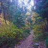
 City Creek North Ridge to Rudy's Flat
10.1 mi 16.2 km • 2,343' Up 714.07 m Up • 2,342' Down 713.81 m Down

 North S…, UT
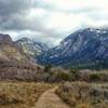
 Elephant Rock Out and Back
7.0 mi 11.2 km • 974' Up 296.8 m Up • 973' Down 296.52 m Down
Woods C…, UT
Deuel Creek Loop
4.6 mi 7.4 km • 973' Up 296.72 m Up • 975' Down 297.11 m Down
Desolation Trail to Salt Lake Overlook
4.4 mi 7.0 km • 1,232' Up 375.55 m Up • 1,231' Down 375.32 m Down
Mount O…, UT
 Broads Fork Twin Peaks
9.6 mi 15.4 km • 5,325' Up 1622.93 m Up • 5,324' Down 1622.68 m Down
Cottonw…, UT
 Bells Canyon Lower Waterfall
5.3 mi 8.6 km • 1,430' Up 435.98 m Up • 1,430' Down 435.84 m Down
Granite, UT


0 Comments