
 Continue with onX Maps
 Continue with Facebook


 Particularly Special Place


 Intermediate/Difficult
Intermediate/Difficult
Intermediate/Difficult
 Intermediate/Difficult
Land Manager: National Park Service - Mount Rainier National Park
 Silver Falls Loop
2.9 mi 4.6 km • 440' Up 134.17 m Up • 426' Down 129.72 m Down
 Tieton, WA
 Indian Bar
14.4 mi 23.2 km • 4,080' Up 1243.62 m Up • 4,104' Down 1250.77 m Down
Eatonville, WA
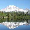
Bench and Snow Lake Trail
2.3 mi 3.7 km • 420' Up 127.89 m Up • 423' Down 128.98 m Down
 Eatonville, WA
Indian Henry's Hunting Ground via Longmire Trail
Eatonville, WA
Indian Henry's Hunting Ground via Longmire Trail
13.2 mi 21.3 km • 3,316' Up 1010.65 m Up • 3,316' Down 1010.63 m Down
Eatonville, WA
Eagle Peak
6.7 mi 10.8 km • 2,880' Up 877.86 m Up • 2,880' Down 877.83 m Down
Eatonville, WA
Palisades Lake
7.3 mi 11.8 km • 1,414' Up 431.13 m Up • 1,415' Down 431.34 m Down


0 Comments