
 Continue with onX Maps
 Continue with Facebook


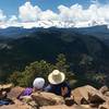
 Particularly Special Place


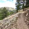
 Difficult


 Difficult
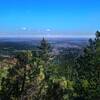
 Flagstaff Summit Loop
2.4 mi 3.9 km • 346' Up 105.4 m Up • 337' Down 102.81 m Down
Boulder, CO
 Anne U. White Trail
3.3 mi 5.3 km • 444' Up 135.23 m Up • 444' Down 135.29 m Down
Boulder, CO
Hogback Ridge Loop
2.1 mi 3.4 km • 740' Up 225.45 m Up • 739' Down 225.39 m Down
Betasso Preserve
7.6 mi 12.2 km • 939' Up 286.1 m Up • 940' Down 286.44 m Down
Boulder, CO
Green Mountain West Ridge
3.9 mi 6.3 km • 633' Up 193.08 m Up • 634' Down 193.23 m Down
Sugarloaf Mountain
1.4 mi 2.2 km • 419' Up 127.76 m Up • 419' Down 127.65 m Down
Boulder, CO


0 Comments