Hiking Project Logo

Meadows, forest, rock slides, waterfalls and a lake end surrounded by 11,000 granite peaks.


Your Rating: Rating Rating Rating Rating Rating      Clear Rating
Your Difficulty:
Your Favorites: Add To-Do · Your List
Zoom in to see details
Map Key

3.8

Miles

6.0

KM

Point to Point

9,250' 2,819 m

High

7,635' 2,327 m

Low

1,657' 505 m

Up

47' 14 m

Down

9%

Avg Grade (5°)

29%

Max Grade (16°)

Dogs Leashed

Features Birding · Cave · Fall Colors · Fishing · Geological Significance · Lake · River/Creek · Spring · Swimming · Views · Waterfall · Wildflowers · Wildlife

Description

Take a high clearance vehicle (we took a Toyota Yaris and went very slow and careful all the way in and parked next to a very large Jeep) up Kane Creek to the trailhead. The trail starts where the road once forded the creek and kept going.

Hike south just under a 1/4 mile to a junction with a forest service sign that lies about the distance to the lake. It is not 3 miles, it is 3.6 miles from the intersection. Go left and over a cool non-OSHA-approved bridge and find you are back on the old road for a while.

The trail holds to that side of the valley all the way to the lake with ever-growing steeper grades. There are shaded areas of woods and open regions of rock slides to traverse. There are several areas that may require a little scrambling to get up or down so know your skills and stay safe.

Contacts

Shared By:

Joseph States

Trail Ratings

  5.0 from 2 votes

#1587

Overall
  5.0 from 2 votes
5 Star
100%
4 Star
0%
3 Star
0%
2 Star
0%
1 Star
0%
Trail Rankings

#34

in Idaho

#1,587

Overall
4 Views Last Month
125 Since Jul 17, 2022
Difficult Difficult

0%
0%
0%
50%
50%
0%

Photos

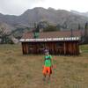
Kane Blue.
Jul 24, 2022 near Sun Valley, ID
Plenty to see
Jul 24, 2022 near Sun Valley, ID

0 Comments

Weather


Current Trail Conditions

Unknown
Add Your Check-In

Check-Ins

Jul 16, 2023
Private User
Welcome

Join the Community! It's FREE

Already have an account? Login to close this notice.