
 Continue with onX Maps
 Continue with Facebook


 Particularly Special Place


 Intermediate/Difficult
Intermediate/Difficult
Intermediate/Difficult
 Intermediate/Difficult
 Devil of a Drop
14.2 mi 22.9 km • 808' Up 246.29 m Up • 6,110' Down 1862.34 m Down
 Joseph, OR
 Granite Mountain Lookout
5.6 mi 9.0 km • 1,732' Up 527.84 m Up • 1,732' Down 527.8 m Down
 McCall, ID
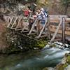
Goose Creek Falls
McCall, ID
Goose Creek Falls
3.1 mi 5.0 km • 759' Up 231.47 m Up • 759' Down 231.39 m Down
McCall, ID
 Ponderosa State Park Big Loop
6.2 mi 9.9 km • 640' Up 194.96 m Up • 638' Down 194.45 m Down
McCall, ID


0 Comments