
 Continue with onX Maps
 Continue with Facebook


 Particularly Special Place


 Intermediate
Intermediate
Intermediate
 Intermediate
Local Club: New England Mountain Bike Association (NEMBA)
Land Manager: Town of Charlemont - Recreation
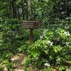
 Mohawk Trail Loop
5.1 mi 8.2 km • 1,133' Up 345.45 m Up • 1,119' Down 341.09 m Down
 Charlemont, MA
 Mount Greylock Summit Loop
6.6 mi 10.7 km • 2,251' Up 686.23 m Up • 2,246' Down 684.66 m Down
 Adams, MA
Bellows Pipe to Mt Greylock Summit
Adams, MA
Bellows Pipe to Mt Greylock Summit
5.8 mi 9.4 km • 2,231' Up 679.9 m Up • 2,231' Down 679.86 m Down
 Leyden Blueberry Fields
7.5 mi 12.1 km • 1,167' Up 355.66 m Up • 1,188' Down 362.11 m Down
Bernard…, MA
Northfield Mountain Trails
11.3 mi 18.3 km • 1,913' Up 583.11 m Up • 1,912' Down 582.9 m Down
Pisgah State Park Ridge Loop
7.9 mi 12.7 km • 767' Up 233.82 m Up • 773' Down 235.67 m Down


0 Comments