
 Continue with onX Maps
 Continue with Facebook


 Particularly Special Place


 Easy
Easy

 Easy
Easy
Land Manager: Dekalb County Parks and Recreation
 Stone Mountain State Park Loop
5.0 mi 8.1 km • 229' Up 69.82 m Up • 230' Down 70.03 m Down
 Stone M…, GA
Lakeside Loop
Stone M…, GA
Lakeside Loop
2.5 mi 4.0 km • 59' Up 18.11 m Up • 60' Down 18.26 m Down
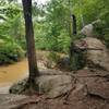
East Palisades Route
4.2 mi 6.8 km • 472' Up 143.77 m Up • 472' Down 143.8 m Down
Vinings, GA
West Palisades Route
3.7 mi 5.9 km • 537' Up 163.63 m Up • 541' Down 164.83 m Down
Island Ford North Loop
2.8 mi 4.4 km • 248' Up 75.49 m Up • 256' Down 78.06 m Down
Dunwoody, GA
Vickery Creek
4.1 mi 6.6 km • 400' Up 121.84 m Up • 401' Down 122.24 m Down


1 Comment