
 Continue with onX Maps
 Continue with Facebook


 Particularly Special Place


 Intermediate/Difficult

 Intermediate/Difficult
Local Club: Ozark Highlands Trail Association
Apr 6, 2024: April 2024 OHTA Newsletter
Apr 6, 2024: March 2024 OHTA Newsletter
Apr 6, 2024: February 2024 OHTA Newsletter
Land Manager: USFS - Ozark-St. Francis National Forest
 Ozark Highlands Trail (OHT)
161.0 mi 259.1 km • 21,776' Up 6637.28 m Up • 22,022' Down 6712.45 m Down
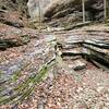
 Yellow Rock Trail - Devil's Den State Park
3.0 mi 4.9 km • 447' Up 136.29 m Up • 448' Down 136.58 m Down
 West Fork, AR
Fossil Flats Trail
West Fork, AR
Fossil Flats Trail
6.1 mi 9.9 km • 761' Up 232.05 m Up • 767' Down 233.91 m Down
 Indian Creek Trail to Eye of the Needle Out and Back
4.6 mi 7.4 km • 527' Up 160.49 m Up • 525' Down 160.07 m Down
Jasper, AR
Cecil Cove Loop to Thunder Canyon Falls
7.5 mi 12.1 km • 693' Up 211.16 m Up • 684' Down 208.54 m Down


0 Comments