
 Continue with onX Maps
 Continue with Facebook


 Particularly Special Place


 Difficult

 Difficult
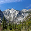
 Copper Creek Trail
13.4 mi 21.6 km • 5,263' Up 1604.11 m Up • 5,262' Down 1603.98 m Down
Squaw V…, CA
 Mist Falls
8.2 mi 13.1 km • 805' Up 245.38 m Up • 804' Down 245.19 m Down
 Squaw V…, CA
Rae Lakes Loop
Squaw V…, CA
Rae Lakes Loop
40.4 mi 65.0 km • 7,007' Up 2135.69 m Up • 7,007' Down 2135.68 m Down
Squaw V…, CA
 Zumwalt Meadows Loop Trail
1.3 mi 2.0 km • 104' Up 31.7 m Up • 123' Down 37.52 m Down
Squaw V…, CA
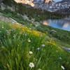
 Morgan Pass and Gem Lake
8.0 mi 12.9 km • 941' Up 286.85 m Up • 942' Down 286.97 m Down
West Bi…, CA
Mono Pass Trail to Summit Lake
4.1 mi 6.5 km • 1,773' Up 540.49 m Up • 142' Down 43.37 m Down


0 Comments