
 Continue with onX Maps
 Continue with Facebook


 Particularly Special Place


 Intermediate
Intermediate
Intermediate
 Intermediate
Land Manager: NPS - Shenandoah National Park
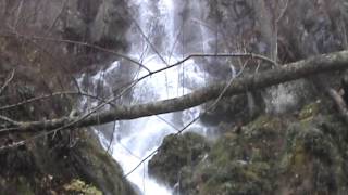
 Dark Hollow Falls
1.7 mi 2.7 km • 495' Up 150.91 m Up • 495' Down 151.02 m Down

 Stanley, VA
 Hawksbill Mountain Loop
2.6 mi 4.2 km • 600' Up 183 m Up • 644' Down 196.36 m Down
Stanley, VA
Whiteoak Canyon to Upper Falls
4.7 mi 7.5 km • 941' Up 286.93 m Up • 942' Down 287.04 m Down
Stanley, VA
Bearfence Loop Trail
1.1 mi 1.8 km • 232' Up 70.77 m Up • 232' Down 70.65 m Down
Stanley, VA
Nicholson Hollow
11.6 mi 18.6 km • 2,092' Up 637.62 m Up • 2,093' Down 637.95 m Down
Mary's Rock Out-and-Back
3.8 mi 6.0 km • 1,105' Up 336.88 m Up • 1,106' Down 337.08 m Down
Luray, VA


0 Comments